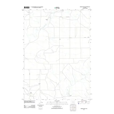
2012 Map of Amend Ranch
USGS Topo · Published 2012About this map
Amend Ranch and several other family-named ranching properties define the rural landscape of this Converse County survey. The map documents a classic Western grazing terrain marked by ephemeral watercourses and scattered ranching hubs. Along the eastern edge, the Prairie View Cem stands as a focal point for local genealogy, situated near Baars Rd. The drainage patterns are dominated by the winding paths of Lost Cr in the north and Muddy Cr in the south, with Watkins Draw cutting through the central hills. A network of rural routes, including Lost Springs Rd and Reese Rd, connects established family operations such as the Ray Reese Ranch, Reese Brothers Ranch, and Moore Ranch. This 2012 snapshot provides a detailed look at contemporary land use and property distributions in a sparsely populated region of Wyoming.
Find a feature on this map
15 named features on this map. Tap any name to fly to it.
Don’t see what you’re looking for? This feature index may not catch every label — zoom into the map to look around manually.
Map Details
Editions of this 2012 Amend Ranch Map
This is the sole edition of this map. No revisions or reprints were ever made.
Other maps of this area

1949 · Shawnee
USGS Topo · 1:24,000

1949 · Cedar Top
USGS Topo · 1:24,000

1950 · Glendo
USGS Topo · 1:24,000

1950 · Amend Ranch
USGS Topo · 1:24,000

1950 · Cedar Top
USGS Topo · 1:24,000

1950 · Prairie View School
USGS Topo · 1:24,000

1950 · Shawnee
USGS Topo · 1:24,000

1950 · Jewel Springs
USGS Topo · 1:24,000

1954 · Torrington
USGS Topo · 1:250,000

1958 · Torrington
USGS Topo · 1:250,000