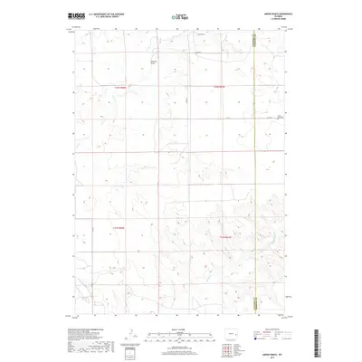
2017 Map of Amend Ranch
USGS Topo · Published 2017About this map
Amend Ranch stands as a focal point in this high-plains landscape where the borders of Converse and Niobrara counties meet. The terrain is defined by the ephemeral drainage patterns of Watkins Draw and the winding course of Muddy Cr to the south, while Lost Cr cuts through the western reaches. This area is characterized by a sparse network of county roads, such as Harris Rd and Baars Rd, which facilitate movement between isolated homesteads and grazing lands. A significant site for local history is the Prairie View Cem, situated on the eastern edge of the quadrangle near the county line. The map illustrates the sprawling nature of Wyoming ranchland in the early twenty-first century, showing how property boundaries and water rights continue to shape the rural settlement pattern in this section of the state.
Find a feature on this map
14 named features on this map. Tap any name to fly to it.
Don’t see what you’re looking for? This feature index may not catch every label — zoom into the map to look around manually.
Map Details
Editions of this 2017 Amend Ranch Map
This is the sole edition of this map. No revisions or reprints were ever made.
Other maps of this area

1949 · Shawnee
USGS Topo · 1:24,000

1949 · Cedar Top
USGS Topo · 1:24,000

1950 · Glendo
USGS Topo · 1:24,000

1950 · Amend Ranch
USGS Topo · 1:24,000

1950 · Cedar Top
USGS Topo · 1:24,000

1950 · Prairie View School
USGS Topo · 1:24,000

1950 · Shawnee
USGS Topo · 1:24,000

1950 · Jewel Springs
USGS Topo · 1:24,000

1954 · Torrington
USGS Topo · 1:250,000

1958 · Torrington
USGS Topo · 1:250,000