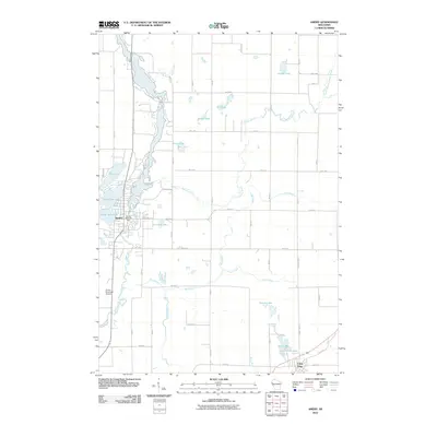
2010 Map of Amery
USGS Topo · Published 2010About this map
Apple River drainage defines the geography of this Polk County region, anchored by the city of Amery. The water-rich landscape is characterized by a series of glacial lakes and tributaries, including North Twin Lake, South Twin Lake, and Lincoln Lake. The Amery Dam stands at the heart of the local waterway system, while infrastructure such as the Amery Municipal Airport and a grid of rural roads like 90th Ave and 70th Ave connect the area's dispersed agricultural and residential plots. To the south, the settlement of Clear Lake sits near the namesake Clear Lake and the smaller Ice House Lake, highlighting the enduring importance of these water bodies to local development. This 2010 survey reflects a quiet rural community where hydrology and land use are deeply intertwined, visible in the way Bull Brook and French Creek weave through the township tracts.
Find a feature on this map
48 named features on this map. Tap any name to fly to it.
Don’t see what you’re looking for? This feature index may not catch every label — zoom into the map to look around manually.
Map Details
Editions of this 2010 Amery Map
This is the sole edition of this map. No revisions or reprints were ever made.
Other maps of this area

1948 · Downing
USGS Topo · 1:62,500

1950 · Downing
USGS Topo · 1:62,500

1950 · Deer Park
USGS Topo · 1:62,500

1950 · Balsam Lake
USGS Topo · 1:62,500

1950 · Turtle Lake
USGS Topo · 1:62,500

1952 · Turtle Lake
USGS Topo · 1:62,500

1953 · Stillwater
USGS Topo · 1:250,000

1955 · Stillwater
USGS Topo · 1:250,000

1958 · Stillwater
USGS Topo · 1:250,000

1965 · Stillwater
USGS Topo · 1:250,000