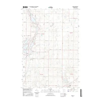
2015 Map of Amery
USGS Topo · Published 2015About this map
Amery is the central hub of this Wisconsin landscape, situated where the Apple River widens into the Apple River Flowage. The map reveals a post-glacial geography dominated by water, from the paired N Twin Lake and S Twin Lake to the smaller Ice House Lake and Gorres Lake scattered across the township lines. The rural infrastructure is well-defined by a network of county roads and avenues that connect the southern settlement of Clear Lake with the municipal center. This 2015 survey illustrates how the local economy and settlement patterns remain anchored to these waterways, with the Amery Municipal Airport serving the region on the western edge of Bull Brook. Along the eastern portion of the sheet, the landscape transitions into more open terrain drained by Beaver Brook and its various tributaries.
Find a feature on this map
87 named features on this map. Tap any name to fly to it.
Don’t see what you’re looking for? This feature index may not catch every label — zoom into the map to look around manually.
Map Details
Editions of this 2015 Amery Map
This is the sole edition of this map. No revisions or reprints were ever made.
Other maps of this area

1948 · Downing
USGS Topo · 1:62,500

1950 · Downing
USGS Topo · 1:62,500

1950 · Deer Park
USGS Topo · 1:62,500

1950 · Balsam Lake
USGS Topo · 1:62,500

1950 · Turtle Lake
USGS Topo · 1:62,500

1952 · Turtle Lake
USGS Topo · 1:62,500

1953 · Stillwater
USGS Topo · 1:250,000

1955 · Stillwater
USGS Topo · 1:250,000

1958 · Stillwater
USGS Topo · 1:250,000

1965 · Stillwater
USGS Topo · 1:250,000