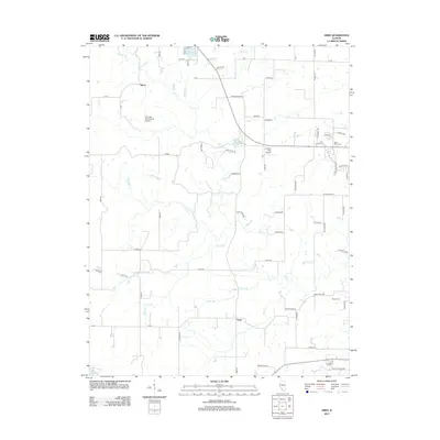
2012 Map of Ames
USGS Topo · Published 2012About this map
Ames and Tipton anchor this rural landscape in Randolph County, where small-town life and agricultural tradition are defined by the winding paths of Horse Cr and its many tributaries. The area is characterized by a network of local family roads and aviation history, evidenced by Our Lady Immaculata Airport and the Duclos RLA Airport. For genealogists, the map preserves the location of several rural burying grounds, including Saint Johns Cem, Saint Peter Cem, Rebenack Cem, and Nelson Cem, which are scattered throughout the countryside. The terrain is marked by the slow movement of the Dry Fork and Prairie Br, flowing toward small water bodies like Lake Emmett and Lake Mildred. This 2012 survey provides a clear view of the modern road network, from Ames Rd to Black Jack Rd, mapping the enduring layout of this Illinois farming community.
Find a feature on this map
63 named features on this map. Tap any name to fly to it.
Don’t see what you’re looking for? This feature index may not catch every label — zoom into the map to look around manually.
Map Details
Editions of this 2012 Ames Map
This is the sole edition of this map. No revisions or reprints were ever made.
Other maps of this area

1910 · Waterloo
USGS Topo · 1:62,500

1912 · New Athens
USGS Topo · 1:62,500

1912 · Baldwin
USGS Topo · 1:62,500

1913 · Waterloo
USGS Topo · 1:62,500

1914 · Baldwin
USGS Topo · 1:62,500

1915 · Renault
USGS Topo · 1:62,500

1940 · Renault
USGS Topo · 1:62,500

1942 · Baldwin
USGS Topo · 1:62,500

1949 · Saint Louis
USGS Topo · 1:250,000

1954 · New Athens West
USGS Topo · 1:24,000