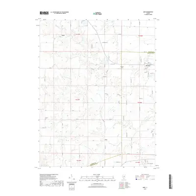
2018 Map of Ames
USGS Topo · Published 2018About this map
Red Bud occupies the northeastern corner of this landscape, where the intersection of W Market St and local routes defines a transition from residential streets to the agricultural expanse of Monroe Co and Randolph Co. The terrain is shaped by the complex drainage of the Horse Creek watershed, including the S Fork Horse Creek and Dry Fork. These waterways carve deep contours through the rural landscape, separating the small settlement of Ames from the northern hamlet of Tipton.
Find a feature on this map
71 named features on this map. Tap any name to fly to it.
Don’t see what you’re looking for? This feature index may not catch every label — zoom into the map to look around manually.
Map Details
Editions of this 2018 Ames Map
This is the sole edition of this map. No revisions or reprints were ever made.
Other maps of this area

1910 · Waterloo
USGS Topo · 1:62,500

1912 · New Athens
USGS Topo · 1:62,500

1912 · Baldwin
USGS Topo · 1:62,500

1913 · Waterloo
USGS Topo · 1:62,500

1914 · Baldwin
USGS Topo · 1:62,500

1915 · Renault
USGS Topo · 1:62,500

1940 · Renault
USGS Topo · 1:62,500

1942 · Baldwin
USGS Topo · 1:62,500

1949 · Saint Louis
USGS Topo · 1:250,000

1954 · New Athens West
USGS Topo · 1:24,000