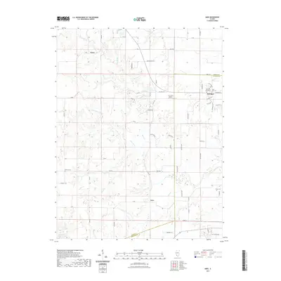
2021 Map of Ames
USGS Topo · Published 2021About this map
The city of Red Bud serves as the primary municipal hub in this region, sitting at the junction of several county roads where the landscape begins to drain toward the Horse Cr system. To the west, the smaller settlements of Tipton and Ames represent the rural character of Randolph and Monroe counties. This survey identifies several significant genealogical sites, including the Saint John the Baptist Catholic Cem, Saint Peter Cem, Rebenack Cem, and Nelson Cem. The terrain is defined by a dense network of tributaries such as Dry Fork, Prairie Br, and Paint Cr that have carved local valleys through the agricultural plains. Aviation interest is noted at the Duclos RLA Airport, while recreational water features like Lake Emmett and Lake Mildred are scattered across the township lines.
Find a feature on this map
69 named features on this map. Tap any name to fly to it.
Don’t see what you’re looking for? This feature index may not catch every label — zoom into the map to look around manually.
Map Details
Editions of this 2021 Ames Map
This is the sole edition of this map. No revisions or reprints were ever made.
Other maps of this area

1910 · Waterloo
USGS Topo · 1:62,500

1912 · New Athens
USGS Topo · 1:62,500

1912 · Baldwin
USGS Topo · 1:62,500

1913 · Waterloo
USGS Topo · 1:62,500

1914 · Baldwin
USGS Topo · 1:62,500

1915 · Renault
USGS Topo · 1:62,500

1940 · Renault
USGS Topo · 1:62,500

1942 · Baldwin
USGS Topo · 1:62,500

1949 · Saint Louis
USGS Topo · 1:250,000

1954 · New Athens West
USGS Topo · 1:24,000