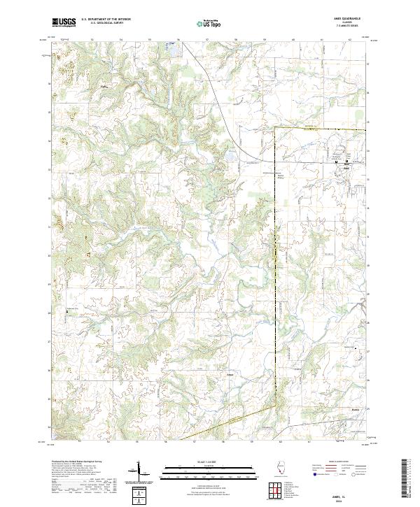
2024 Map of Ames
USGS Topo · Published 2024About this map
The rolling hills of the Illinois countryside near the Monroe and Randolph county line are defined by the intricate drainages of Horse Creek and its many tributaries. The settlement of Ames serves as a central point in this landscape, while the more developed outskirts of Red Bud appear in the northeast, marked by Saint John the Baptist Catholic Cem and Saint Peter Cem. The terrain is deeply etched by waterways like South Fork Horse Creek, Dry Fork, and Prairie Branch, which create a complex network of ridges and valleys that have historically dictated the placement of roads and farmsteads.
Find a feature on this map
69 named features on this map. Tap any name to fly to it.
Don’t see what you’re looking for? This feature index may not catch every label — zoom into the map to look around manually.
Map Details
Editions of this 2024 Ames Map
This is the sole edition of this map. No revisions or reprints were ever made.
Other maps of this area

1910 · Waterloo
USGS Topo · 1:62,500

1912 · New Athens
USGS Topo · 1:62,500

1912 · Baldwin
USGS Topo · 1:62,500

1913 · Waterloo
USGS Topo · 1:62,500

1914 · Baldwin
USGS Topo · 1:62,500

1915 · Renault
USGS Topo · 1:62,500

1940 · Renault
USGS Topo · 1:62,500

1942 · Baldwin
USGS Topo · 1:62,500

1949 · Saint Louis
USGS Topo · 1:250,000

1954 · New Athens West
USGS Topo · 1:24,000