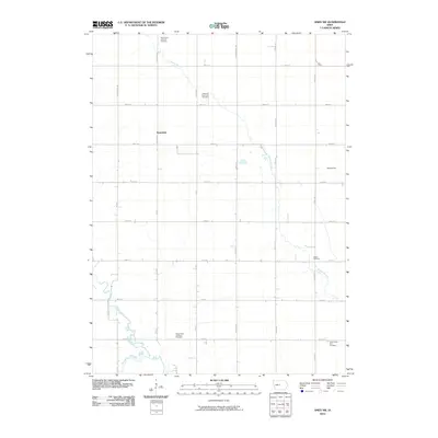
2010 Map of Ames NW
USGS Topo · Published 2010About this map
The unincorporated settlement of Rosendale sits at the heart of this rural Iowa landscape, where the agricultural grid is defined by a dense network of local roads like Nelson Ave and 390th St. This 2010 survey of Clear Lake Township reveals a territory deeply tied to its heritage through its numerous burial grounds, including Saint Paul's Lutheran Cemetery in the north and the South Saint Petri Cemetery near the southern boundary. These cemeteries, alongside Ellsworth Clear Lake Cemetery and Saints Peter and Paul Cemetery, offer significant points of interest for genealogists tracing family histories in Hamilton and Story counties. The terrain is drained by several meandering watercourses, most notably Keigley Branch, which cuts diagonally across the township, and the headwaters of Squaw Creek and Montgomery Creek in the southwest.
Find a feature on this map
31 named features on this map. Tap any name to fly to it.
Don’t see what you’re looking for? This feature index may not catch every label — zoom into the map to look around manually.
Map Details
Editions of this 2010 Ames NW Map
This is the sole edition of this map. No revisions or reprints were ever made.
Other maps of this area

1912 · Ames
USGS Topo · 1:62,500

1914 · Ames
USGS Topo · 1:62,500

1916 · Boone
USGS Topo · 1:62,500

1954 · Waterloo
USGS Topo · 1:250,000

1955 · Waterloo
USGS Topo · 1:250,000

1965 · Mackey
USGS Topo · 1:24,000
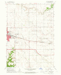
1965 · Boone East
USGS Topo · 1:24,000

1975 · Ames NW
USGS Topo · 1:24,000

1975 · Ames West
USGS Topo · 1:24,000

1975 · Story City
USGS Topo · 1:24,000
Featured Places
- Clear Lake Township, IA
- Harrison Township, IA
- Ellsworth Township, IA
- Lafayette Township, IA
- Story County, IA