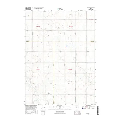
2015 Map of Ames NW
USGS Topo · Published 2015About this map
Keigley Br meanders through this portion of central Iowa, where the borders of Hamilton, Boone, and Story counties converge. The landscape is defined by its rectilinear grid of township roads and agricultural properties, interspersed with vital community anchors. Local heritage is deeply rooted in sites like Saint Paul's Church and several historic burial grounds, including the Ellsworth Clear Lake Cem and the Saints Peter and Paul Cem. The drainage patterns of Squaw Creek and Montgomery Cr influence the local topography, while the northern edge of the map is marked by the proximity of Little Wall Lake Rd, indicating the transition toward the nearby glacial lake region. This survey captures the enduring rural structure of the region in the mid-2010s.
Find a feature on this map
41 named features on this map. Tap any name to fly to it.
Don’t see what you’re looking for? This feature index may not catch every label — zoom into the map to look around manually.
Map Details
Editions of this 2015 Ames NW Map
This is the sole edition of this map. No revisions or reprints were ever made.
Other maps of this area

1912 · Ames
USGS Topo · 1:62,500

1914 · Ames
USGS Topo · 1:62,500

1916 · Boone
USGS Topo · 1:62,500

1954 · Waterloo
USGS Topo · 1:250,000

1955 · Waterloo
USGS Topo · 1:250,000

1965 · Mackey
USGS Topo · 1:24,000
1965 · Boone East
USGS Topo · 1:24,000

1975 · Ames NW
USGS Topo · 1:24,000

1975 · Ames West
USGS Topo · 1:24,000

1975 · Story City
USGS Topo · 1:24,000
Featured Places
- Clear Lake Township, IA
- Harrison Township, IA
- Ellsworth Township, IA
- Lafayette Township, IA
- Story County, IA