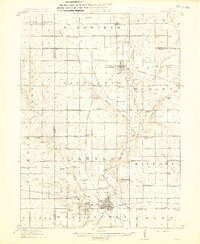
1914 Map of Ames
USGS Topo · Published 1914About this map
Ames serves as the hub of this Central Iowa landscape, dominated by the campus of Iowa State College and the confluence of Squaw Creek and the Skunk River. The rail network defines the era's commerce, with the Chicago and Northwestern and the Minneapolis and St Louis lines threading through rural townships to connect settlements like Story City, Gilbert, and Roland.
Find a feature on this map
75 named features on this map. Tap any name to fly to it.
Don’t see what you’re looking for? This feature index may not catch every label — zoom into the map to look around manually.
Map Details
Editions of this 1914 Ames Map
3 editions found
Other maps of this area

1911 · Madrid
USGS Topo · 1:62,500

1911 · Slater
USGS Topo · 1:62,500

1912 · Ames
USGS Topo · 1:62,500

1913 · Slater
USGS Topo · 1:62,500

1914 · Madrid
USGS Topo · 1:62,500

1914 · Ames
USGS Topo · 1:62,500

1916 · Boone
USGS Topo · 1:62,500

1954 · Waterloo
USGS Topo · 1:250,000

1954 · Des Moines
USGS Topo · 1:250,000

1955 · Waterloo
USGS Topo · 1:250,000