Loading...
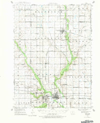
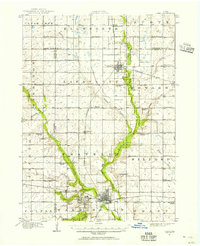
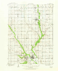
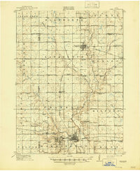
Loading map...1912 Map of Ames
USGS Topo · Published 1983About this map
Iowa State College stands at the heart of this central Iowa landscape, surrounded by the growing town of Ames and its satellite communities like Ontario and College. The 1912 survey reveals a meticulously organized agricultural grid across Story, Hamilton, and Boone counties, where nearly every section is anchored by a named country schoolhouse. These rural centers, such as Zenoirville School, Tjernagel School, and Mc Farland School, represent the localized social fabric of the era before the consolidation of the mid-twentieth century.
Find a feature on this map
72 named features on this map. Tap any name to fly to it.
Don’t see what you’re looking for? This feature index may not catch every label — zoom into the map to look around manually.
Map Details
Date Portrayed1912
Date Published1983
PublisherU.S. Geological Survey
Map TypeTopographic
Scale1:62,500
Physical Dimensions17.1 x 21 inches
Editions of this 1912 Ames Map
Historical Maps of Ames Through Time
4 maps found


Featured Locations
Source Details
SourceU.S. Geological Survey
CopyrightPublic Domain