Loading...
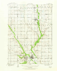
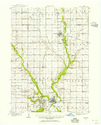
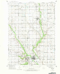
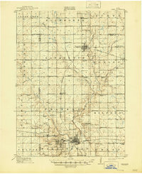
Loading map...1912 Map of Ames
USGS Topo · Published 1968About this map
Iowa State College anchors the southern portion of this 1912 survey, situated just west of the growing hub of Ames. The landscape is defined by the diverging paths of Squaw Creek and the Skunk River, which carve through a dense grid of rural townships. This era of Story County history is characterized by an extraordinary concentration of country schoolhouses, with nearly every section of land serviced by local institutions like the Copenhagen School, Reischauer School, and Zenorville School.
Find a feature on this map
73 named features on this map. Tap any name to fly to it.
Don’t see what you’re looking for? This feature index may not catch every label — zoom into the map to look around manually.
Map Details
Date Portrayed1912
Date Published1968
PublisherU.S. Geological Survey
Map TypeTopographic
Scale1:62,500
Physical Dimensions17 x 21 inches
Editions of this 1912 Ames Map
Historical Maps of Ames Through Time
4 maps found


Featured Locations
Source Details
SourceU.S. Geological Survey
CopyrightPublic Domain