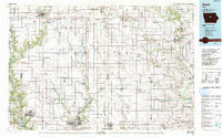
1993 Map of Ames
USGS Topo · Published 1993About this map
The South Skunk River and Iowa River systems define this central Iowa landscape, where the agricultural grid is punctuated by university expansion and state-managed conservation areas. In the southern reach, Iowa State University anchors the growth of Ames, while the Chicago and North Western railroad provides a primary transport spine connecting smaller grain-handling settlements like Jewell and Radcliffe.
Find a feature on this map
127 named features on this map. Tap any name to fly to it.
Don’t see what you’re looking for? This feature index may not catch every label — zoom into the map to look around manually.
Map Details
Editions of this 1993 Ames Map
This is the sole edition of this map. No revisions or reprints were ever made.
Other maps of this area

1911 · Madrid
USGS Topo · 1:62,500

1911 · Slater
USGS Topo · 1:62,500

1912 · Ames
USGS Topo · 1:62,500

1913 · Slater
USGS Topo · 1:62,500

1914 · Madrid
USGS Topo · 1:62,500

1914 · Ames
USGS Topo · 1:62,500

1916 · Boone
USGS Topo · 1:62,500

1923 · Lehigh
USGS Topo · 1:62,500

1923 · Fort Dodge
USGS Topo · 1:62,500

1950 · Perry
USGS Topo · 1:62,500