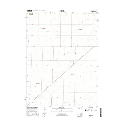
2016 Map of Amherst
USGS Topo · Published 2016About this map
The settlement of Amherst serves as the focal point of this 2016 survey, situated in the High Plains of northeastern Colorado. The landscape is defined by a rigorous grid of county roads, such as Co RD 36 and Co RD 51, which crisscross the agricultural terrain. This rectilinear pattern is briefly interrupted by the diagonal path of a rail corridor running through the town center, where Monmouth Ave provides local access.
Find a feature on this map
26 named features on this map. Tap any name to fly to it.
Don’t see what you’re looking for? This feature index may not catch every label — zoom into the map to look around manually.
Map Details
Editions of this 2016 Amherst Map
This is the sole edition of this map. No revisions or reprints were ever made.
Other maps of this area

1952 · Julesburg SE
USGS Topo · 1:24,000

1954 · Sterling
USGS Topo · 1:250,000

1958 · Sterling
USGS Topo · 1:250,000

1962 · Venango SW
USGS Topo · 1:24,000

1962 · Holyoke NE
USGS Topo · 1:24,000

1962 · Amherst
USGS Topo · 1:24,000

1962 · Amherst NE
USGS Topo · 1:24,000
1962 · Venango
USGS Topo · 1:24,000

1971 · Amherst SW
USGS Topo · 1:24,000

1971 · Holyoke
USGS Topo · 1:24,000