Loading...
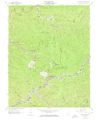
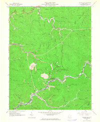
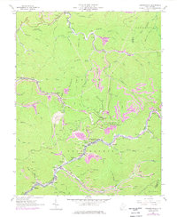
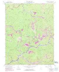
Loading map...1963 Map of Amherstdale
USGS Topo · Published 1973About this map
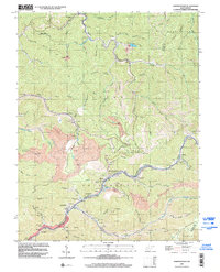
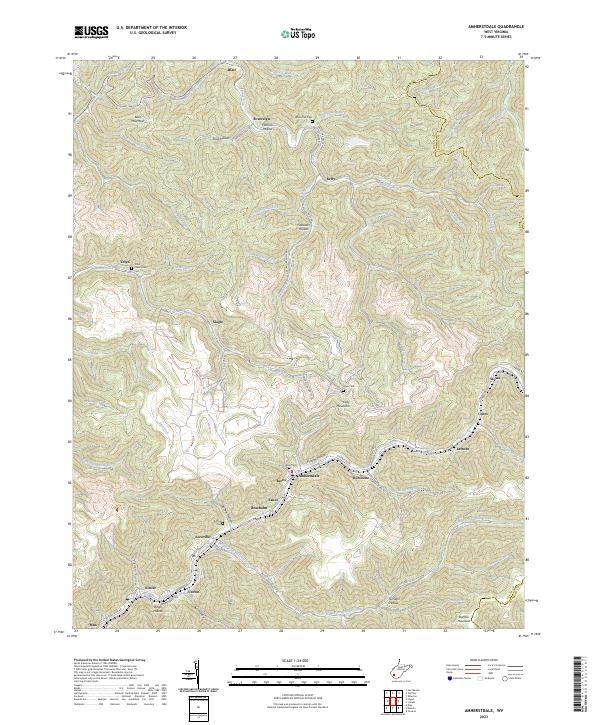
Amherstdale and the surrounding coal-mining communities of the Triadelphia district are documented here during the early 1960s. The map captures an era when the Chesapeake and Ohio railroad snaked through the hollows of the Buffalo Mountain region, serving numerous industrial sites including strip mines and mine dumps at Slagle and Robinette. The landscape is a complex network of company towns and family-named landmarks, from the Mt Olive Ch in Fanco to the Ruffner Cem near Accoville.
Find a feature on this map
93 named features on this map. Tap any name to fly to it.
Don’t see what you’re looking for? This feature index may not catch every label — zoom into the map to look around manually.
Map Details
Date Portrayed1963
Date Published1973
PublisherU.S. Geological Survey
Map TypeTopographic
Scale1:24,000
Physical Dimensions22 x 26.8 inches
Editions of this 1963 Amherstdale Map
4 editions found
Historical Maps of Man Through Time
7 maps found


Featured Locations
Source Details
SourceU.S. Geological Survey
CopyrightPublic Domain