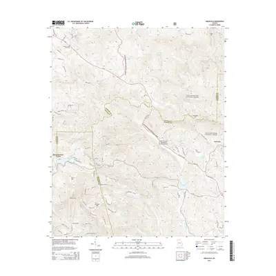
2014 Map of Amicalola
USGS Topo · Published 2014About this map
Chattahoochee National Forest dominates the landscape of this 2014 survey, a region where the borders of Dawson, Gilmer, and Pickens counties converge. The rugged topography is defined by significant peaks like Amicalola Mtn, Sassafras Mtn, and Burnt Mtn, interspersed with deep valleys such as Horse Cove. This modern edition documents the established footprint of Camp Frank D. Merrill near the center of the sheet, an Army training facility situated at the gateway to the Blue Ridge mountains. Genealogical and local history points of interest include the Ebenezer Baptist Church Cem in the northwest and small residential developments like Burnt Mountain Estates. Hydrological features include the headwaters of Amicalola Cr and several high-elevation bodies of water, including Sequoyah Lake, Kincaid Lake, and Fausett Lake.
Find a feature on this map
80 named features on this map. Tap any name to fly to it.
Don’t see what you’re looking for? This feature index may not catch every label — zoom into the map to look around manually.
Map Details
Editions of this 2014 Amicalola Map
This is the sole edition of this map. No revisions or reprints were ever made.
Other maps of this area

1888 · Ellijay
USGS Topo · 1:125,000

1890 · Suwanee
USGS Topo · 1:125,000

1892 · Ellijay
USGS Topo · 1:125,000

1894 · Suwanee
USGS Topo · 1:125,000

1898 · Ellijay
USGS Topo · 1:125,000

1911 · Ellijay
USGS Topo · 1:125,000

1926 · Tate
USGS Topo · 1:62,500

1928 · Tate
USGS Topo · 1:62,500

1935 · Noontootla
USGS Topo · 1:24,000

1935 · Tickanetley
USGS Topo · 1:24,000