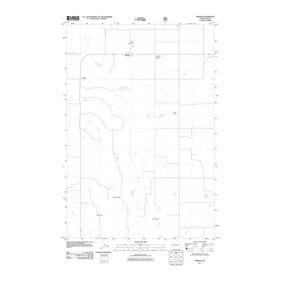
2011 Map of Amidon
USGS Topo · Published 2011About this map
Amidon serves as the focal point of this Slope County landscape, situated along the northern tier of the quadrangle. The town's local significance is underscored by the presence of the Slope County Fairgrounds and Sadler Field just to the north and east. The surrounding terrain is defined by dramatic geological features, most notably the high elevations of White Butte and the distinctive formations of Chalky Buttes to the west. These landmarks sit above the drainage patterns of Duff Gulch and the winding course of Sand Creek, which cuts through the southwestern corner of the sheet. For those researching local heritage, the map identifies two key burial sites: Lebanon Cemetery and Saints Peter and Paul Cemetery, providing clear spatial context for these community landmarks in a region characterized by expansive rural spacing and a grid of local routes like County Rd 33.
Find a feature on this map
11 named features on this map. Tap any name to fly to it.
Don’t see what you’re looking for? This feature index may not catch every label — zoom into the map to look around manually.
Map Details
Editions of this 2011 Amidon Map
This is the sole edition of this map. No revisions or reprints were ever made.
Other maps of this area

1953 · Dickinson
USGS Topo · 1:250,000

1957 · Dickinson
USGS Topo · 1:250,000

1961 · Daglum
USGS Topo · 1:62,500

1961 · Rocky Ridge
USGS Topo · 1:62,500

1973 · Black Butte
USGS Topo · 1:24,000

1973 · White Lake
USGS Topo · 1:24,000

1973 · Mineral Springs
USGS Topo · 1:24,000

1973 · Amidon SE
USGS Topo · 1:24,000

1973 · Stewart Lake
USGS Topo · 1:24,000

1973 · Amidon
USGS Topo · 1:24,000