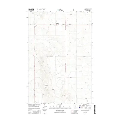
2014 Map of Amidon
USGS Topo · Published 2014About this map
White Butte, the highest natural point in North Dakota, rises prominently in the southern portion of this landscape within the Little Missouri National Grassland. The small community of Amidon serves as a central hub, situated along the intersection of US Hwy 85 and 2nd St. The terrain is defined by dramatic erosional features like the Chalky Buttes and the deep incision of Duff Gulch, showcasing the transition from high plains to badlands topography. Local heritage is marked by several burial sites, including Lebanon Cem west of the highway and Saints Peter and Paul Cem to the east. Drainage patterns are established by seasonal watercourses such as Sand Cr and N Cedar Cr, which navigate the high-elevation plateaus and steep breaks characteristic of Slope County.
Find a feature on this map
22 named features on this map. Tap any name to fly to it.
Don’t see what you’re looking for? This feature index may not catch every label — zoom into the map to look around manually.
Map Details
Editions of this 2014 Amidon Map
This is the sole edition of this map. No revisions or reprints were ever made.
Other maps of this area

1953 · Dickinson
USGS Topo · 1:250,000

1957 · Dickinson
USGS Topo · 1:250,000

1961 · Daglum
USGS Topo · 1:62,500

1961 · Rocky Ridge
USGS Topo · 1:62,500

1973 · Black Butte
USGS Topo · 1:24,000

1973 · White Lake
USGS Topo · 1:24,000

1973 · Mineral Springs
USGS Topo · 1:24,000

1973 · Amidon SE
USGS Topo · 1:24,000

1973 · Stewart Lake
USGS Topo · 1:24,000

1973 · Amidon
USGS Topo · 1:24,000