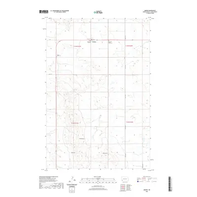
2020 Map of Amidon
USGS Topo · Published 2020About this map
Amidon serves as the small but vital center of this North Dakota landscape, notably housing the Slope County Courthouse. The map highlights a transition from the agricultural plateaus to the striking geological formations of the Chalky Buttes and the prominent height of White Butte to the south. This terrain is carved by drainage patterns like Duff Gulch and the winding course of Sand Cr. Local genealogy is anchored by the presence of Lebanon Lutheran Cem to the west and Saints Peter and Paul Catholic Cem to the east, reflecting the denominational heritage of the early settlers who established this high-plains community. The rectangular survey grid, marked by sections like t135n r101w, organizes the vast ranching and farming lands that surround the county seat.
Find a feature on this map
21 named features on this map. Tap any name to fly to it.
Don’t see what you’re looking for? This feature index may not catch every label — zoom into the map to look around manually.
Map Details
Editions of this 2020 Amidon Map
This is the sole edition of this map. No revisions or reprints were ever made.
Other maps of this area

1953 · Dickinson
USGS Topo · 1:250,000

1957 · Dickinson
USGS Topo · 1:250,000

1961 · Daglum
USGS Topo · 1:62,500

1961 · Rocky Ridge
USGS Topo · 1:62,500

1973 · Black Butte
USGS Topo · 1:24,000

1973 · White Lake
USGS Topo · 1:24,000

1973 · Mineral Springs
USGS Topo · 1:24,000

1973 · Amidon SE
USGS Topo · 1:24,000

1973 · Stewart Lake
USGS Topo · 1:24,000

1973 · Amidon
USGS Topo · 1:24,000