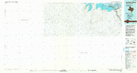
1985 Map of Amistad Village
USGS Topo · Published 1993About this map
Amistad Reservoir dominates the northeastern landscape of this mid-1980s survey, illustrating the vast expanse created by the impoundment of the Rio Grande. The map highlights the development of Amistad Village and the significant infrastructure of the Amistad Dam along the international border. This 1:100,000-scale study reveals the transition of the West Texas river valley into a major recreation and water management hub, documented within the Amistad National Recreation Area. While the United States portion in Val Verde Co is detailed from recent aerial photography and earlier topographic sheets, the area south of the river is noted with a lack of available international data, emphasizing the map's focus on the northern shoreline and its surrounding desert topography during a period of established regional water infrastructure.
Find a feature on this map
7 named features on this map. Tap any name to fly to it.
Don’t see what you’re looking for? This feature index may not catch every label — zoom into the map to look around manually.
Map Details
Editions of this 1985 Amistad Village Map
2 editions found
Other maps of this area

1941 · Feely
USGS Topo · 1:62,500

1943 · Devils River
USGS Topo · 1:62,500

1943 · Del Rio
USGS Topo · 1:62,500

1944 · Sycamore Ranch
USGS Topo · 1:62,500

1944 · Devils River
USGS Topo · 1:62,500

1944 · Mouth Of Pecos
USGS Topo · 1:62,500

1944 · Devils Lake
USGS Topo · 1:62,500

1958 · Eagle Pass
USGS Topo · 1:250,000

1958 · Del Rio
USGS Topo · 1:250,000

1959 · Emory Peak
USGS Topo · 1:250,000