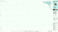
1985 Map of Amistad Village
USGS Topo · Published 1985About this map
The Amistad Reservoir dominates the landscape of Val Verde Co in the mid-1980s, serving as a critical binational water resource along the United States Mexico border. This planimetric study focuses on the infrastructure supporting the border region, from the monumental Amistad Dam to the official Port of Entry. The map details the confluence of the Rio Grande and the Devils River, illustrating how the massive impoundment transformed the desert terrain into the Amistad National Recreation Area.
Find a feature on this map
15 named features on this map. Tap any name to fly to it.
Don’t see what you’re looking for? This feature index may not catch every label — zoom into the map to look around manually.
Map Details
Editions of this 1985 Amistad Village Map
2 editions found
Other maps of this area

1941 · Feely
USGS Topo · 1:62,500

1943 · Devils River
USGS Topo · 1:62,500

1943 · Del Rio
USGS Topo · 1:62,500

1944 · Sycamore Ranch
USGS Topo · 1:62,500

1944 · Devils River
USGS Topo · 1:62,500

1944 · Mouth Of Pecos
USGS Topo · 1:62,500

1944 · Devils Lake
USGS Topo · 1:62,500

1958 · Eagle Pass
USGS Topo · 1:250,000

1958 · Del Rio
USGS Topo · 1:250,000

1959 · Emory Peak
USGS Topo · 1:250,000