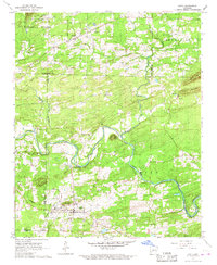
1966 Map of Amity
USGS Topo · Published 1967About this map
The Caddo River winds through this mid-1960s landscape, providing the primary hydrological focus for the town of Amity and its surrounding rural townships. The settlement patterns are typical of the Ouachita foothills, where small communities like Welsh and schools such as Grandview Sch were established near dependable water sources and rail lines. The Missouri Pacific railroad cuts across the lower portion of the map, serving as a critical transport link for the region's timber and agricultural interests.
Find a feature on this map
37 named features on this map. Tap any name to fly to it.
Don’t see what you’re looking for? This feature index may not catch every label — zoom into the map to look around manually.
Map Details
Editions of this 1966 Amity Map
This is the sole edition of this map. No revisions or reprints were ever made.
Other maps of this area

1906 · Caddo Gap
USGS Topo · 1:125,000

1936 · Glenwood
USGS Topo · 1:48,000

1942 · Glenwood
USGS Topo · 1:62,500

1943 · Antoine
USGS Topo · 1:62,500

1949 · Glenwood
USGS Topo · 1:62,500

1955 · Little Rock
USGS Topo · 1:250,000

1956 · Little Rock
USGS Topo · 1:250,000

1960 · Little Rock
USGS Topo · 1:250,000

1964 · Little Rock
USGS Topo · 1:250,000

1966 · Pearcy
USGS Topo · 1:24,000