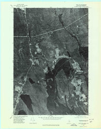
1975 Map of Amity SE
USGS Topo · Published 1980About this map
The international border between the United States and Canada bisects the deep waters of the Chiputneticook Lakes in this orthophoto study of the Maine and New Brunswick frontier. This visual record, derived from 1975 aerial photography, documents the rural landscape of Aroostook County where the Maine-New Brunswick line follows the winding course of Monument Brook through dense timberland. Small settlements like Orient on the western shore and Fosterville to the east flank the lake system, connected by narrow roads that cut through the forest.
Find a feature on this map
10 named features on this map. Tap any name to fly to it.
Don’t see what you’re looking for? This feature index may not catch every label — zoom into the map to look around manually.
Map Details
Editions of this 1975 Amity SE Map
2 editions found
Other maps of this area

1940 · Danforth
USGS Topo · 1:62,500

1940 · Amity
USGS Topo · 1:62,500

1940 · Forest
USGS Topo · 1:62,500

1941 · Danforth
USGS Topo · 1:62,500

1941 · Amity
USGS Topo · 1:62,500

1942 · Forest
USGS Topo · 1:62,500

1943 · Danforth
USGS Topo · 1:62,500

1943 · Amity
USGS Topo · 1:62,500

1957 · Fredericton
USGS Topo · 1:250,000
1958 · Danforth
USGS Topo · 1:62,500