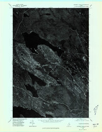
1975 Map of Scraggly Lake SE
USGS Topo · Published 1980About this map
Scraggly Lake and Grand Lake dominate this 1975 orthophotograph, which provides a detailed aerial view of the Maine wilderness within Aroostook County. Unlike traditional line-drawn maps, this image-based survey by the Geological Survey reveals the complex network of logging roads and forest clearings as they existed in the mid-1970s. The terrain is defined by low-lying ridges including Mt Delight and Mt Pineo, which overlook the vast dark expanses of the glacial lakes. For researchers, the map serves as a primary source for identifying the exact timber harvest patterns and shorelines before later development or regrowth altered the character of this northern interior landscape.
Find a feature on this map
4 named features on this map. Tap any name to fly to it.
Don’t see what you’re looking for? This feature index may not catch every label — zoom into the map to look around manually.
Map Details
Editions of this 1975 Scraggly Lake SE Map
2 editions found
Other maps of this area

1940 · Danforth
USGS Topo · 1:62,500

1940 · Amity
USGS Topo · 1:62,500

1940 · Forest
USGS Topo · 1:62,500

1941 · Danforth
USGS Topo · 1:62,500

1941 · Amity
USGS Topo · 1:62,500

1942 · Forest
USGS Topo · 1:62,500

1943 · Danforth
USGS Topo · 1:62,500

1943 · Amity
USGS Topo · 1:62,500

1957 · Fredericton
USGS Topo · 1:250,000
1958 · Danforth
USGS Topo · 1:62,500