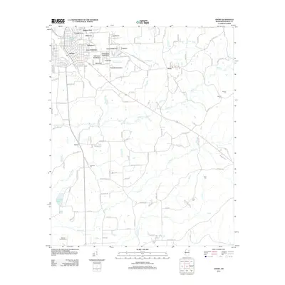
2012 Map of Amory
USGS Topo · Published 2012About this map
Amory serves as the focal point of this Monroe County survey, showing a dense network of residential subdivisions and industrial infrastructure. The rail-centric character of the town is evident along the BNSF Railway, which cuts through the heart of the community near neighborhoods like Colonial Acres and Easthaven. This map captures a landscape defined by its residential growth, particularly in the numerous subdivisions such as Wildwood, Hedgemoor, and Love Subdivision that expand outward from the town center.
Find a feature on this map
156 named features on this map. Tap any name to fly to it.
Don’t see what you’re looking for? This feature index may not catch every label — zoom into the map to look around manually.
Map Details
Editions of this 2012 Amory Map
This is the sole edition of this map. No revisions or reprints were ever made.
Other maps of this area

1953 · West Point
USGS Topo · 1:250,000

1956 · Tupelo
USGS Topo · 1:250,000

1958 · Tupelo
USGS Topo · 1:250,000

1958 · West Point
USGS Topo · 1:250,000

1963 · West Point
USGS Topo · 1:250,000

1966 · Smithville
USGS Topo · 1:24,000

1966 · Aberdeen
USGS Topo · 1:24,000

1966 · Amory
USGS Topo · 1:24,000

1966 · Amory SW
USGS Topo · 1:24,000

1966 · Turon
USGS Topo · 1:24,000