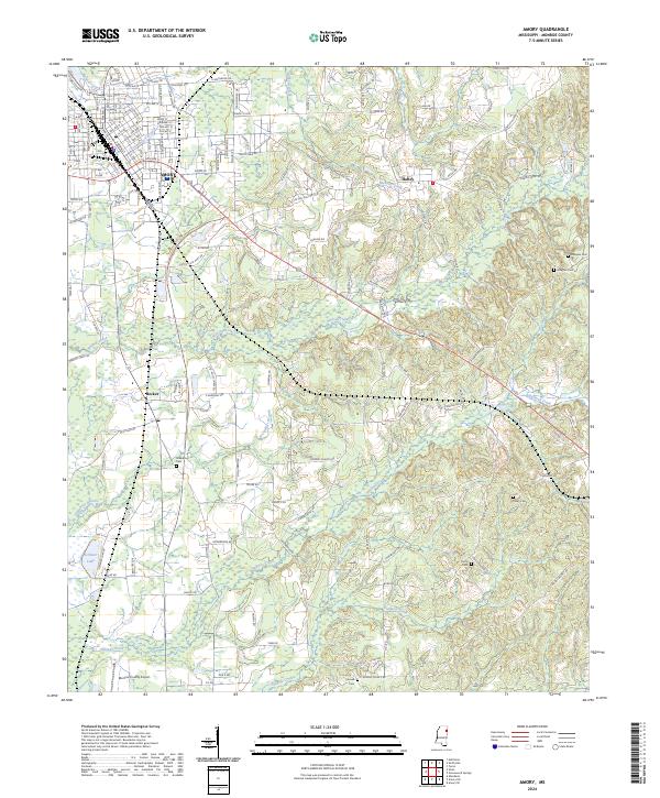
2024 Map of Amory
USGS Topo · Published 2024About this map
Amory serves as the primary hub in this portion of Monroe County, showing a detailed street grid and rail infrastructure dominated by the BNSF Railway. The settlement pattern extends south to the community of Becker and east toward Hatley, with the landscape transitioning into a network of small creeks and family-named landmarks. Waterways like Greenbrier Branch and Halfway Creek drain the undulating terrain, punctuated by significant local sites including the Monroe County Airport and Scribner Lake. For those researching local lineages, the map records several rural burial grounds such as Posey Cem, Camp Cem, and Greenbrier Cem. The presence of McAlpine Lake near the northern industrial and residential sectors of the city highlights the proximity of natural water features to the urban center.
Find a feature on this map
152 named features on this map. Tap any name to fly to it.
Don’t see what you’re looking for? This feature index may not catch every label — zoom into the map to look around manually.
Map Details
Editions of this 2024 Amory Map
This is the sole edition of this map. No revisions or reprints were ever made.
Other maps of this area

1953 · West Point
USGS Topo · 1:250,000

1956 · Tupelo
USGS Topo · 1:250,000

1958 · Tupelo
USGS Topo · 1:250,000

1958 · West Point
USGS Topo · 1:250,000

1963 · West Point
USGS Topo · 1:250,000

1966 · Smithville
USGS Topo · 1:24,000

1966 · Aberdeen
USGS Topo · 1:24,000

1966 · Amory
USGS Topo · 1:24,000

1966 · Amory SW
USGS Topo · 1:24,000

1966 · Turon
USGS Topo · 1:24,000