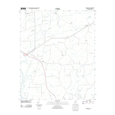
2012 Map of Amory SW
USGS Topo · Published 2012About this map
Athens and the surrounding Monroe County countryside are defined by a network of creeks and scattered rural settlements just east of the Tombigbee River. This landscape is marked by numerous family and community burial grounds, including Buckingham Cem, Burns Cem, and the McDuffie Cemetery. The local transport network is anchored by Old Highway 45 S and Old Highway 25, which cut through a terrain drained by Butler Cr and Stonewall Cr. To the north, the Monroe County Airport sits near the headwaters of Tadpole Cr. This 2012 survey illustrates the persistent rural character of the region, where legacy names like Lackey and Westville remain tied to the land near Weeks Lake and the various branches of Wilson Cr.
Find a feature on this map
87 named features on this map. Tap any name to fly to it.
Don’t see what you’re looking for? This feature index may not catch every label — zoom into the map to look around manually.
Map Details
Editions of this 2012 Amory SW Map
This is the sole edition of this map. No revisions or reprints were ever made.
Other maps of this area

1953 · West Point
USGS Topo · 1:250,000

1958 · West Point
USGS Topo · 1:250,000

1959 · West Point
USGS Topo · 1:62,500

1960 · Caledonia
USGS Topo · 1:62,500

1963 · West Point
USGS Topo · 1:250,000

1966 · Aberdeen
USGS Topo · 1:24,000

1966 · Amory
USGS Topo · 1:24,000

1966 · Amory SW
USGS Topo · 1:24,000

1966 · Wren
USGS Topo · 1:24,000

1966 · Greenwood Springs
USGS Topo · 1:24,000