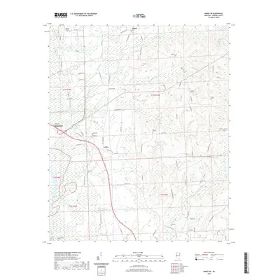
2020 Map of Amory SW
USGS Topo · Published 2020About this map
The Tombigbee River basin dominates the western edge of this survey, where the landscape transitions into the rolling terrain of Monroe County. Small rural settlements like Lackey and Athens anchor the interior, connected by a network of secondary roads such as Old Hwy 45 and Old Columbus Rd. The area is notably dense with family and community burial grounds, including Beeks Cem, Burns Cem, and Berry Cem, which provide significant points of interest for genealogical research. To the northwest, the Monroe County Airport sits near the outskirts of Aberdeen, while the eastern portion of the quadrangle is defined by the headwaters of numerous creeks, such as Stonewall Cr and Butler Cr, flowing toward the river valley. The map reveals a persistent pattern of rural land use, where small-scale farming and timber interests are interspersed with historic local landmarks like Pleasant Hill Cem and New Prospect Cem.
Find a feature on this map
77 named features on this map. Tap any name to fly to it.
Don’t see what you’re looking for? This feature index may not catch every label — zoom into the map to look around manually.
Map Details
Editions of this 2020 Amory SW Map
This is the sole edition of this map. No revisions or reprints were ever made.
Other maps of this area

1953 · West Point
USGS Topo · 1:250,000

1958 · West Point
USGS Topo · 1:250,000

1959 · West Point
USGS Topo · 1:62,500

1960 · Caledonia
USGS Topo · 1:62,500

1963 · West Point
USGS Topo · 1:250,000

1966 · Aberdeen
USGS Topo · 1:24,000

1966 · Amory
USGS Topo · 1:24,000

1966 · Amory SW
USGS Topo · 1:24,000

1966 · Wren
USGS Topo · 1:24,000

1966 · Greenwood Springs
USGS Topo · 1:24,000