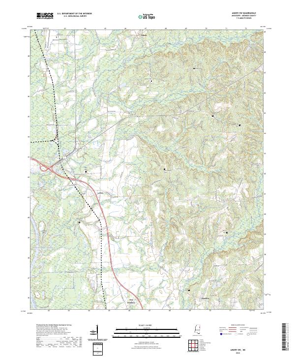
2024 Map of Amory SW
USGS Topo · Published 2024About this map
Athens and Lackey anchor the northern and central stretches of this modern topographical study, revealing the evolving rural landscape of Monroe County. The drainage patterns of Tadpole Creek and Nichols Creek define the local topography, while the engineered channel of the Tennessee-Tombigbee Waterway runs along the western edge, marking a significant era of water management and navigation. Historic river crossings are noted by Lackeys Ferry, a name that points to the area's older transportation networks before modern bridges spanned the Tombigbee.
Find a feature on this map
82 named features on this map. Tap any name to fly to it.
Don’t see what you’re looking for? This feature index may not catch every label — zoom into the map to look around manually.
Map Details
Editions of this 2024 Amory SW Map
This is the sole edition of this map. No revisions or reprints were ever made.
Other maps of this area

1953 · West Point
USGS Topo · 1:250,000

1958 · West Point
USGS Topo · 1:250,000

1959 · West Point
USGS Topo · 1:62,500

1960 · Caledonia
USGS Topo · 1:62,500

1963 · West Point
USGS Topo · 1:250,000

1966 · Aberdeen
USGS Topo · 1:24,000

1966 · Amory
USGS Topo · 1:24,000

1966 · Amory SW
USGS Topo · 1:24,000

1966 · Wren
USGS Topo · 1:24,000

1966 · Greenwood Springs
USGS Topo · 1:24,000