
1966 Map of Amory SW
USGS Topo · Published 1967About this map
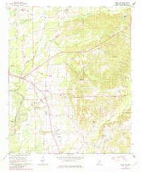
The Tombigbee River winds along the western edge of this Monroe County landscape, defining a terrain of river bottomlands and rising eastern uplands. During the mid-1960s, this area supported a mix of rural industry and essential infrastructure, from the Monroe County Airport and its Beacon in the northwest to the St Louis-San Francisco railroad line cutting through Lackey. Local history is deeply etched into the land through numerous family and community landmarks, including the County Home and its associated County Home Cem. The map reveals a transition in land use, showing active Gravel Pits and a Clay Pit alongside agricultural features like the Fish Hatchery and Robertson Landing Strip. Named water bodies such as Tadpole Creek, Nichols Creek, and Broyles Creek drain the hills, where small rural congregations gathered at Athens Ch and Fig Hill Ch.
Find a feature on this map
41 named features on this map. Tap any name to fly to it.
Don’t see what you’re looking for? This feature index may not catch every label — zoom into the map to look around manually.
Map Details
Editions of this 1966 Amory SW Map
2 editions found
Other maps of this area

1953 · West Point
USGS Topo · 1:250,000

1958 · West Point
USGS Topo · 1:250,000

1959 · West Point
USGS Topo · 1:62,500

1960 · Caledonia
USGS Topo · 1:62,500

1963 · West Point
USGS Topo · 1:250,000

1966 · Aberdeen
USGS Topo · 1:24,000

1966 · Amory
USGS Topo · 1:24,000

1966 · Wren
USGS Topo · 1:24,000

1966 · Greenwood Springs
USGS Topo · 1:24,000

1966 · Amory SE
USGS Topo · 1:24,000