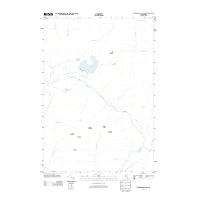
2013 Map of Ampersand Lake
USGS Topo · Published 2013About this map
Ampersand Lake sits at the heart of this high-elevation landscape, where the hydrography of the northern Adirondacks is defined by a network of remote ponds and brooks. The terrain is dominated by the Seward Mountains, a cluster of significant peaks including Donaldson Mountain, Seymour Mountain, and Mount Emmons. These summits are divided by deep gaps like Ouluska Pass, which channels the drainage of the headwaters into the Cold River and Seward Brook. Only a few traces of human infrastructure appear, notably Ampersand Rd and Preston Rd, which provide limited access to this mountainous area. The map documents a landscape of numerous isolated water bodies such as White Lily Pond, Blueberry Pond, and Seward Pond, illustrating the intricate natural drainage patterns that characterize this part of Franklin County.
Find a feature on this map
27 named features on this map. Tap any name to fly to it.
Don’t see what you’re looking for? This feature index may not catch every label — zoom into the map to look around manually.
Map Details
Editions of this 2013 Ampersand Lake Map
This is the sole edition of this map. No revisions or reprints were ever made.
Other maps of this area

1902 · Saranac
USGS Topo · 1:62,500

1904 · Saranac
USGS Topo · 1:62,500

1904 · Santanoni
USGS Topo · 1:62,500

1904 · Long Lake
USGS Topo · 1:62,500

1905 · Saint Regis
USGS Topo · 1:62,500

1948 · Ogdensburg
USGS Topo · 1:250,000

1951 · Ogdensburg
USGS Topo · 1:250,000

1953 · Ogdensburg
USGS Topo · 1:250,000

1953 · Santanoni
USGS Topo · 1:62,500

1955 · Long Lake
USGS Topo · 1:62,500