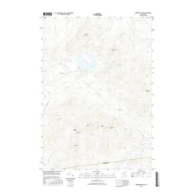
2016 Map of Ampersand Lake
USGS Topo · Published 2016About this map
Ampersand Lake lies at the heart of this high-elevation landscape within the Adirondack Park, where the headwaters of the Cold River and numerous mountain brooks drain a dense network of peaks. The topography is dominated by the Seward Mountains in the south, including the prominent summits of Seward Mtn, Donaldson Mtn, and Mt Emmons. This 2016 survey illustrates the wild character of the Franklin and Essex county line, where vehicular access is restricted to primitive routes like Ampersand Rd and Preston Rd. A significant natural corridor is formed by Ouluska Pass, situated between the Seward range and Seymour Mtn. The map records an environment defined by water and rock, from the remote Seward Pond to the high ridges of Van Dorrien Mtn and the Sawtooth Mountains.
Find a feature on this map
32 named features on this map. Tap any name to fly to it.
Don’t see what you’re looking for? This feature index may not catch every label — zoom into the map to look around manually.
Map Details
Editions of this 2016 Ampersand Lake Map
This is the sole edition of this map. No revisions or reprints were ever made.
Other maps of this area

1902 · Saranac
USGS Topo · 1:62,500

1904 · Saranac
USGS Topo · 1:62,500

1904 · Santanoni
USGS Topo · 1:62,500

1904 · Long Lake
USGS Topo · 1:62,500

1905 · Saint Regis
USGS Topo · 1:62,500

1948 · Ogdensburg
USGS Topo · 1:250,000

1951 · Ogdensburg
USGS Topo · 1:250,000

1953 · Ogdensburg
USGS Topo · 1:250,000

1953 · Santanoni
USGS Topo · 1:62,500

1955 · Long Lake
USGS Topo · 1:62,500