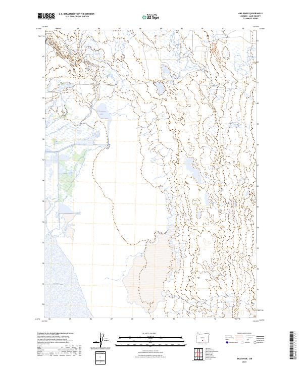
2023 Map of Ana River
USGS Topo · Published 2023About this map
Ana River flows through this high desert basin in Lake County, serving as a vital artery for the Summer Lake Migratory Waterfowl and Game Management Area. The landscape is defined by the intersection of freshwater sources and alkaline basins, where Schoolhouse Lake and Buckhorn Spring provide localized water points in an otherwise arid environment. The vast wetlands shown here are part of a critical conservation corridor, with the northern reaches of Summer Lake dominating the southern portion of the quadrangle. Transportation is limited to a few essential routes like Co HWY 4-17, reflecting the area's sparse settlement and focus on wildlife habitat and natural resource management within the cadastral frameworks of t30s r17e and t31s r17e.
Find a feature on this map
10 named features on this map. Tap any name to fly to it.
Don’t see what you’re looking for? This feature index may not catch every label — zoom into the map to look around manually.
Map Details
Editions of this 2023 Ana River Map
This is the sole edition of this map. No revisions or reprints were ever made.
Other maps of this area

1955 · Crescent
USGS Topo · 1:250,000

1955 · Klamath Falls
USGS Topo · 1:250,000

1957 · Crescent
USGS Topo · 1:250,000

1958 · Crescent
USGS Topo · 1:250,000

1958 · Klamath Falls
USGS Topo · 1:250,000

1966 · Summer Lake
USGS Topo · 1:24,000

1966 · Fremont Point
USGS Topo · 1:24,000

1970 · Crescent
USGS Topo · 1:250,000

1974 · Lake Abert
USGS Topo · 1:100,000
1982 · Egli Rim
USGS Topo · 1:24,000