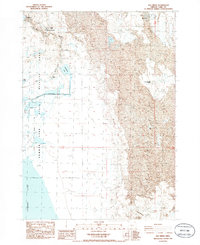
1986 Map of Ana River
USGS Topo · Published 1986About this map
Summer Lake State Wildlife Area dominates this arid landscape at the northern edge of the Summer Lake basin, where managed water systems meet the high desert. The hydrological infrastructure is central to the area's utility, featuring the Ana Reservoir, a prominent Canal, and various levees that redirect the Ana River. This 1980s-era survey highlights the tension between the wet marshes of Schoolhouse Lake and the surrounding desert features like Alkali Flat and shifting Sand Dunes. For the local historian, the map preserves the location of established ranching outposts such as Thousand Springs Ranch, River Ranch, and the Carlon Ranch. Isolated landmarks like The Rosebud and the Lost Cabin provide specific points of interest for those studying the human footprint in this sparsely populated region of Lake County.
Find a feature on this map
21 named features on this map. Tap any name to fly to it.
Don’t see what you’re looking for? This feature index may not catch every label — zoom into the map to look around manually.
Map Details
Editions of this 1986 Ana River Map
This is the sole edition of this map. No revisions or reprints were ever made.
Other maps of this area

1955 · Crescent
USGS Topo · 1:250,000

1955 · Klamath Falls
USGS Topo · 1:250,000

1957 · Crescent
USGS Topo · 1:250,000

1958 · Crescent
USGS Topo · 1:250,000

1958 · Klamath Falls
USGS Topo · 1:250,000

1966 · Summer Lake
USGS Topo · 1:24,000

1966 · Fremont Point
USGS Topo · 1:24,000

1970 · Crescent
USGS Topo · 1:250,000

1974 · Lake Abert
USGS Topo · 1:100,000
1982 · Egli Rim
USGS Topo · 1:24,000