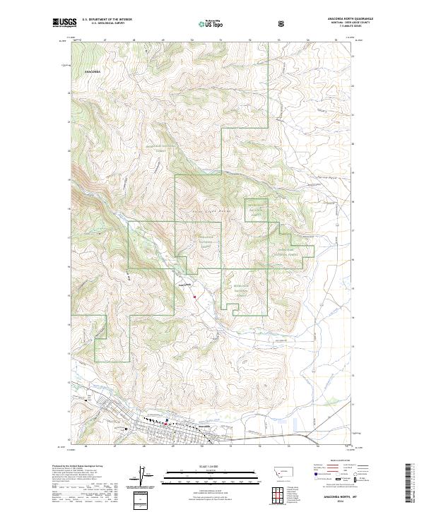
2024 Map of Anaconda North
USGS Topo · Published 2024About this map
Anaconda occupies the southern edge of this survey, where the valley floor meets the rising peaks of the Flint Creek Range. The town grid is highly detailed, showing a concentration of named streets from W Park Ave to E Front St, along with significant local landmarks like New Hill Cem and Mount Olivet Cem. These features reflect the community's growth along Warm Springs Creek and the historical influence of industrial development in the Deer Lodge Valley.
Find a feature on this map
73 named features on this map. Tap any name to fly to it.
Don’t see what you’re looking for? This feature index may not catch every label — zoom into the map to look around manually.
Map Details
Editions of this 2024 Anaconda North Map
This is the sole edition of this map. No revisions or reprints were ever made.
Other maps of this area

1889 · Helena
USGS Topo · 1:250,000

1893 · Helena
USGS Topo · 1:250,000

1899 · Helena
USGS Topo · 1:250,000

1903 · Helena
USGS Topo · 1:250,000

1908 · Philipsburg
USGS Topo · 1:125,000

1947 · Butte
USGS Topo · 1:250,000

1958 · Butte
USGS Topo · 1:250,000

1960 · Butte
USGS Topo · 1:250,000

1961 · Anaconda
USGS Topo · 1:62,500

1962 · Butte
USGS Topo · 1:250,000