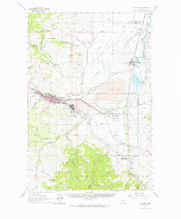
1961 Map of Anaconda
USGS Topo · Published 1964About this map
Industrial dominance and institutional expansion define this 1960s study of the Deer Lodge Valley. The Anaconda Smelter complex stands as a massive landmark south of Anaconda, connected to the wider region by the Butte Anaconda and Pacific and Northern Pacific railroads. The map documents a significant concentration of state facilities, including the State Hospital and State Game Farm at Warm Springs, as well as the State Sanitarium further north at Galen.
Find a feature on this map
71 named features on this map. Tap any name to fly to it.
Don’t see what you’re looking for? This feature index may not catch every label — zoom into the map to look around manually.
Map Details
Editions of this 1961 Anaconda Map
This is the sole edition of this map. No revisions or reprints were ever made.
Other maps of this area

1889 · Helena
USGS Topo · 1:250,000

1893 · Helena
USGS Topo · 1:250,000

1893 · Dillon
USGS Topo · 1:250,000

1899 · Helena
USGS Topo · 1:250,000

1903 · Helena
USGS Topo · 1:250,000
1908 · Philipsburg
USGS Topo · 1:125,000

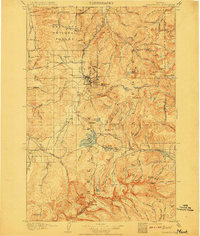
1947 · Butte
USGS Topo · 1:250,000

1955 · Dillon
USGS Topo · 1:250,000

1957 · Dillon
USGS Topo · 1:250,000

1958 · Butte
USGS Topo · 1:250,000