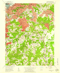
1956 Map of Anacostia
USGS Topo · Published 1958About this map
The Anacostia River and its surrounding heights characterize this mid-century view of the developing border between the District of Columbia and Prince George's County. In the north, dense urban neighborhoods like Randle Highlands and Twining give way to the sprawling campus of St Elizabeths Hospital and the significant military presence at Camp Simms. The landscape transitions from the established residential blocks of Anacostia into the burgeoning post-war suburbs of Suitland, District Heights, and Morningside, where new schools such as Suitland High Sch and Mt Calvary Sch appear alongside traditional landmarks.
Find a feature on this map
108 named features on this map. Tap any name to fly to it.
Don’t see what you’re looking for? This feature index may not catch every label — zoom into the map to look around manually.
Map Details
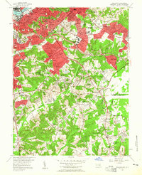
Editions of this 1956 Anacostia Map
2 editions found
Other maps of this area

1890 · Mt. Vernon
USGS Topo · 1:125,000

1891 · Mt. Vernon
USGS Topo · 1:125,000

1892 · Brandywine
USGS Topo · 1:62,500

1894 · Mt. Vernon
USGS Topo · 1:125,000

1895 · Brandywine
USGS Topo · 1:62,500

1897 · Mt. Vernon
USGS Topo · 1:125,000

1899 · Patuxent
USGS Topo · 1:125,000

1900 · Washington
USGS Topo · 1:62,500

1906 · Patuxent
USGS Topo · 1:125,000

1911 · Brandywine
USGS Topo · 1:62,500