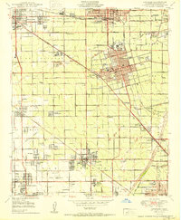
1950 Map of Anaheim
USGS Topo · Published 1950About this map
The Santa Ana River corridor in 1950 reveals a transition from vast ranch lands to dense citrus-era urbanization. In Fullerton and Anaheim, the street grid is already established around civic landmarks like the Fullerton Municipal Airport and the Anaheim Cemetery. Beyond the primary city centers, several ethnic and labor-based enclaves are visible, including Colonia Independencia and Colonia Manzanillo, alongside institutional sites like the County Farm and Hospital.
Find a feature on this map
100 named features on this map. Tap any name to fly to it.
Don’t see what you’re looking for? This feature index may not catch every label — zoom into the map to look around manually.
Map Details
Editions of this 1950 Anaheim Map
This is the sole edition of this map. No revisions or reprints were ever made.
Other maps of this area

1896 · Santa Ana
USGS Topo · 1:62,500

1896 · Anaheim
USGS Topo · 1:62,500

1896 · Las Bolsas
USGS Topo · 1:62,500

1896 · Downey
USGS Topo · 1:62,500

1898 · Anaheim
USGS Topo · 1:62,500

1899 · Downey
USGS Topo · 1:62,500

1901 · Southern California Sheet No. 1
USGS Topo · 1:250,000

1901 · Santa Ana
USGS Topo · 1:62,500

1901 · Anaheim
USGS Topo · 1:62,500

1902 · Downey
USGS Topo · 1:62,500