
Loading...
Loading map...1983 Map of Anahuac
USGS Topo · Published 1983About this map
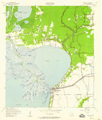
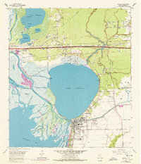
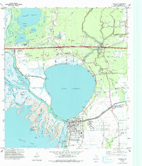
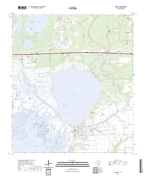
The industrial and coastal landscapes of the Upper Texas Coast are captured here during the early 1980s, centered on the settlement of Anahuac and the expansive waters of Trinity Bay. This era of the Gulf Coast economy is evidenced by the density of energy infrastructure, including the famous Spindletop Oil Field, Anahuac Oil Field, and Oyster Bayou Oil Field. These sites are linked by a complex network of roads like Texas 124 and the tracks of the Missouri Pacific and Southern Pacific railroads.
Find a feature on this map
117 named features on this map. Tap any name to fly to it.
Don’t see what you’re looking for? This feature index may not catch every label — zoom into the map to look around manually.
Map Details
Date Portrayed1983
Date Published1983
PublisherU.S. Geological Survey
Map TypeTopographic
Scale1:100,000
Physical Dimensions44.5 x 24.1 inches
Editions of this 1983 Anahuac Map
2 editions found

Historical Maps of Pasadena Through Time
5 maps found
Featured Locations
Source Details
SourceU.S. Geological Survey
CopyrightPublic Domain