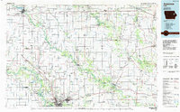
1984 Map of Anamosa
USGS Topo · Published 1985About this map
The Wapsipinicon River and the Maquoketa River carve a winding course through this eastern Iowa landscape, anchoring a network of small agricultural settlements and state institutions. Large-scale land use is marked by the Independence State Hospital in the northwest and the State Penal Farm near Anamosa, while the Manchester National Fish Hatchery sits along the Spring Branch. This 1980s planimetric survey reveals a region defined by its natural topography and conservation efforts, featuring numerous protected areas such as Pictured Rocks State Park, Wapsipinicon State Park, and Wildcat Bluff State Park.
Find a feature on this map
148 named features on this map. Tap any name to fly to it.
Don’t see what you’re looking for? This feature index may not catch every label — zoom into the map to look around manually.
Map Details
Editions of this 1984 Anamosa Map
2 editions found
Other maps of this area

1887 · Cedar Rapids
USGS Topo · 1:62,500

1888 · Shellsburg
USGS Topo · 1:62,500

1888 · Marion
USGS Topo · 1:62,500

1888 · Amana
USGS Topo · 1:62,500

1889 · Tipton
USGS Topo · 1:62,500

1889 · Marion
USGS Topo · 1:62,500

1889 · Amana
USGS Topo · 1:62,500

1889 · Shellsburg
USGS Topo · 1:62,500

1890 · Tipton
USGS Topo · 1:62,500

1890 · Anamosa
USGS Topo · 1:62,500