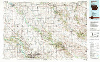
1984 Map of Anamosa
USGS Topo · Published 1988About this map
Independence State Hospital and the winding course of the Wapsipinicon River anchor this 1980s-era study of East Central Iowa. The landscape is a network of small agricultural hubs and riverside recreation areas, including Wapsipinicon State Park and Pictured Rocks State Park. Major transportation corridors like U.S. 20 and U.S. 151 connect historical settlements such as Monticello, Manchester, and Independence. Significant institutional landmarks are present, including the Manchester Fish Hatchery and the State Penal Farm. The map documents a mature rail infrastructure featuring the Illinois Central Gulf Railroad, the Milwaukee Road, and the Chicago and North Western Transportation Co, highlighting the region's reliance on these lines for moving goods between the numerous scattered quarries and larger markets like nearby Cedar Rapids.
Find a feature on this map
111 named features on this map. Tap any name to fly to it.
Don’t see what you’re looking for? This feature index may not catch every label — zoom into the map to look around manually.
Map Details
Editions of this 1984 Anamosa Map
2 editions found
Other maps of this area

1887 · Cedar Rapids
USGS Topo · 1:62,500

1888 · Shellsburg
USGS Topo · 1:62,500

1888 · Marion
USGS Topo · 1:62,500

1888 · Amana
USGS Topo · 1:62,500

1889 · Tipton
USGS Topo · 1:62,500

1889 · Marion
USGS Topo · 1:62,500

1889 · Amana
USGS Topo · 1:62,500

1889 · Shellsburg
USGS Topo · 1:62,500

1890 · Tipton
USGS Topo · 1:62,500

1890 · Anamosa
USGS Topo · 1:62,500