
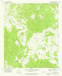
1973 Map of Ancho
USGS Topo · Published 1977About this map
The settlement of Ancho serves as a focal point in this high-desert landscape, situated where the Southern Pacific railroad cuts through the valley. This 1973 survey details a region defined by its ranching and mining heritage, featuring the Ancho Cem and several resource extraction sites like the Jicarilla Mine and various unnamed Mines. The terrain transitions from the low-lying Ancho Gulch toward the higher elevations of the Jicarilla Mountains and Jacks Peak, with much of the southern portion preserved within the Lincoln National Forest. Significant family holdings, including the Miller Ranch and Wilson Ranch, are clearly marked alongside essential water sources such as Sinks Tank and the Wilson Tanks, which were vital for sustaining livestock and industry in the arid New Mexico climate.
Find a feature on this map
31 named features on this map. Tap any name to fly to it.
Don’t see what you’re looking for? This feature index may not catch every label — zoom into the map to look around manually.
Map Details
Editions of this 1973 Ancho Map
This is the sole edition of this map. No revisions or reprints were ever made.
Other maps of this area

1950 · Little Black Peak
USGS Topo · 1:62,500

1954 · Fort Sumner
USGS Topo · 1:250,000

1955 · Roswell
USGS Topo · 1:250,000

1958 · Fort Sumner
USGS Topo · 1:250,000

1958 · Roswell
USGS Topo · 1:250,000

1962 · Roswell
USGS Topo · 1:250,000

1973 · Chupadero Mountain
USGS Topo · 1:24,000
1973 · White Oaks North
USGS Topo · 1:24,000

1973 · Jicarilla Peak
USGS Topo · 1:24,000

1980 · Corona
USGS Topo · 1:100,000