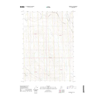
2021 Map of Anchorage A-7 NW
USGS Topo · Published 2021About this map
Little Teton Mtn and Temptation Peak define the high-altitude landscape east of the Anchorage basin. This 2021 survey by the U.S. Geological Survey illustrates a transition from the limited residential developments along Hiland Road and West River Drive in the northeast to the protected wilderness of the Chugach range. The map reveals a sophisticated network of recreational access points, with the Rendezvous Ridge Trl and Rendezvous Peak Trl navigating the northern ridges while the Near Point Trl and Wolverine Peak Trl provide routes through the southwestern peaks. These trail systems often parallel major watercourses such as Ship Cr and the S Fork Eagle River, which have carved deep drainage patterns like the Campbell Creek Canyon found near Tanaina Peak.
Find a feature on this map
25 named features on this map. Tap any name to fly to it.
Don’t see what you’re looking for? This feature index may not catch every label — zoom into the map to look around manually.
Map Details
Editions of this 2021 Anchorage A-7 NW Map
This is the sole edition of this map. No revisions or reprints were ever made.
Other maps of this area

1951 · Anchorage
USGS Topo · 1:250,000

1952 · Anchorage A-8
USGS Topo · 1:63,360

1952 · Anchorage B-8
USGS Topo · 1:63,360

1953 · Anchorage A-8
USGS Topo · 1:63,360

1953 · Anchorage B-8
USGS Topo · 1:63,360

1960 · Anchorage B-7
USGS Topo · 1:63,360

1960 · Anchorage A-7
USGS Topo · 1:63,360

1962 · Anchorage
USGS Topo · 1:250,000

1965 · Anchorage B-8
USGS Topo · 1:63,360

1979 · Anchorage B-7 SW
USGS Topo · 1:25,000