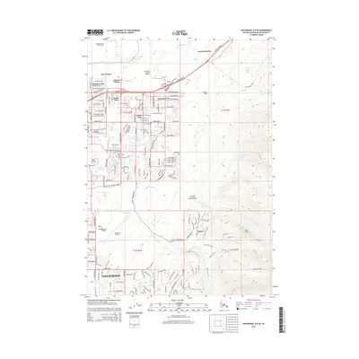
2015 Map of Anchorage A-8 NE
USGS Topo · Published 2015About this map
Fort Richardson and Elmendorf Air Force Base dominate the northern landscape of this northeastern Anchorage survey, where military infrastructure meets the expanding residential grid. The transition from urban density to the foothills of the Chugach Mountains is clearly defined by neighborhoods such as Mountain View, Wonder Park, and Artesian Village. This map captures the intricate hydrology of the area, featuring the winding paths of Ship Cr and the multiple forks of Campbell Creek, including N Fork Little Campbell Cr. The eastern portion reveals more dramatic relief, showing the ascent toward Wolverine Peak and Near Point. Cultural landmarks like Alaska Pacific University and the aviation-focused Campbell Airstrip illustrate the diverse land use in this sub-arctic environment, while smaller enclaves like Basher sit on the edge of Campbell Creek Canyon.
Find a feature on this map
75 named features on this map. Tap any name to fly to it.
Don’t see what you’re looking for? This feature index may not catch every label — zoom into the map to look around manually.
Map Details
Editions of this 2015 Anchorage A-8 NE Map
This is the sole edition of this map. No revisions or reprints were ever made.
Other maps of this area

1951 · Anchorage
USGS Topo · 1:250,000

1952 · Anchorage A-8
USGS Topo · 1:63,360

1952 · Anchorage B-8
USGS Topo · 1:63,360

1953 · Anchorage A-8
USGS Topo · 1:63,360

1953 · Anchorage B-8
USGS Topo · 1:63,360

1960 · Anchorage B-7
USGS Topo · 1:63,360

1960 · Anchorage A-7
USGS Topo · 1:63,360

1962 · Anchorage
USGS Topo · 1:250,000

1965 · Anchorage B-8
USGS Topo · 1:63,360

1979 · Anchorage B-7 SW
USGS Topo · 1:25,000