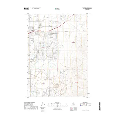
2021 Map of Anchorage A-8 NE
USGS Topo · Published 2021About this map
Anchorage and its eastern suburbs are mapped in high detail, showing the city's interface with the foothills of the Chugach Mountains. The residential patterns of Artesian Village, Mountain View, and DeBarr Vista define the urban landscape north of the Alaska Pacific University campus. This modern survey illustrates the extensive trail systems and recreation areas that weave through the municipal greenbelts, including the Campbell Creek Trl and various bear-themed paths like Black Bear Trl and Brown Bear Trl.
Find a feature on this map
69 named features on this map. Tap any name to fly to it.
Don’t see what you’re looking for? This feature index may not catch every label — zoom into the map to look around manually.
Map Details
Editions of this 2021 Anchorage A-8 NE Map
This is the sole edition of this map. No revisions or reprints were ever made.
Other maps of this area

1951 · Anchorage
USGS Topo · 1:250,000

1952 · Anchorage A-8
USGS Topo · 1:63,360

1952 · Anchorage B-8
USGS Topo · 1:63,360

1953 · Anchorage A-8
USGS Topo · 1:63,360

1953 · Anchorage B-8
USGS Topo · 1:63,360

1960 · Anchorage B-7
USGS Topo · 1:63,360

1960 · Anchorage A-7
USGS Topo · 1:63,360

1962 · Anchorage
USGS Topo · 1:250,000

1965 · Anchorage B-8
USGS Topo · 1:63,360

1979 · Anchorage B-7 SW
USGS Topo · 1:25,000