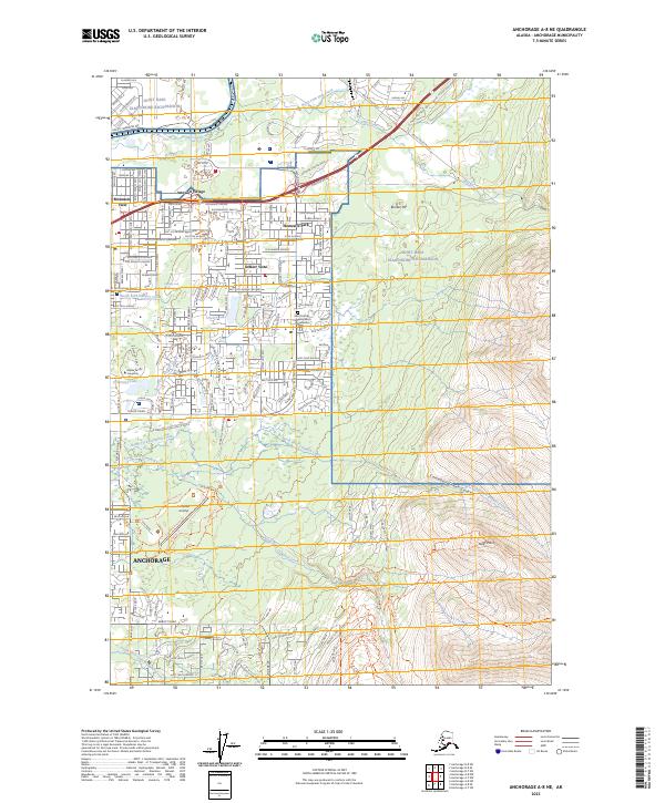
2023 Map of Anchorage A-8 NE
USGS Topo · Published 2023About this map
The northeastern reaches of Anchorage meet the transition to the Chugach foothills, where residential neighborhoods like Artesian Village, Mountain View, and Homesite Park give way to the extensive grounds of Joint Base Elmendorf-Richardson. This area is defined by its numerous recreational and utility waterways, including Ship Creek, North Fork Chester Creek, and University Lake, which sits adjacent to Alaska Pacific University.
Find a feature on this map
40 named features on this map. Tap any name to fly to it.
Don’t see what you’re looking for? This feature index may not catch every label — zoom into the map to look around manually.
Map Details
Editions of this 2023 Anchorage A-8 NE Map
This is the sole edition of this map. No revisions or reprints were ever made.
Other maps of this area

1951 · Anchorage
USGS Topo · 1:250,000

1952 · Anchorage A-8
USGS Topo · 1:63,360

1952 · Anchorage B-8
USGS Topo · 1:63,360

1953 · Anchorage A-8
USGS Topo · 1:63,360

1953 · Anchorage B-8
USGS Topo · 1:63,360

1960 · Anchorage B-7
USGS Topo · 1:63,360

1960 · Anchorage A-7
USGS Topo · 1:63,360

1962 · Anchorage
USGS Topo · 1:250,000

1965 · Anchorage B-8
USGS Topo · 1:63,360

1979 · Anchorage B-7 SW
USGS Topo · 1:25,000