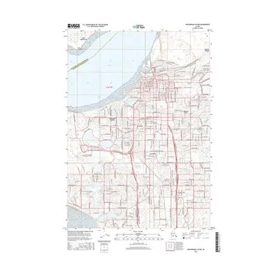
2016 Map of Anchorage A-8 NW
USGS Topo · Published 2016About this map
Knik Arm defines the northwestern boundary of this coastal survey, where the urban expansion of Alaska's largest city meets the tides. The map documents a dense network of neighborhoods including Spenard, Turnagain Heights, and Rogers Park, showing the transition from the industrial waterfront along Ship Creek to the residential developments south of Merrill Field. The landscape is remarkably watery, dotted with numerous named bodies such as Campbell Lake, Jewel Lake, and Westchester Lagoon, which are interspersed among major transportation hubs. The sprawling footprint of the Ted Stevens Anchorage International Airport occupies the western shoreline, while the Univ of Alaska Anchorage campus anchors the central-east. From the railroad-related infrastructure near Wilson Village to the suburban street grids extending toward Campbell, this map provides a comprehensive record of the city's modern layout and its integration with the surrounding coastal environment.
Find a feature on this map
132 named features on this map. Tap any name to fly to it.
Don’t see what you’re looking for? This feature index may not catch every label — zoom into the map to look around manually.
Map Details
Editions of this 2016 Anchorage A-8 NW Map
This is the sole edition of this map. No revisions or reprints were ever made.
Other maps of this area

1949 · Tyonek
USGS Topo · 1:250,000

1951 · Anchorage
USGS Topo · 1:250,000

1951 · Tyonek
USGS Topo · 1:250,000

1951 · Tyonek A-1
USGS Topo · 1:63,360

1952 · Tyonek A-1
USGS Topo · 1:63,360

1952 · Anchorage A-8
USGS Topo · 1:63,360

1952 · Anchorage B-8
USGS Topo · 1:63,360

1953 · Anchorage A-8
USGS Topo · 1:63,360

1953 · Anchorage B-8
USGS Topo · 1:63,360

1958 · Tyonek B-1
USGS Topo · 1:63,360