
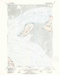
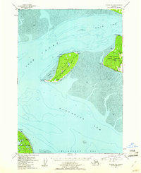
1952 Map of Tyonek A-1
USGS Topo · Published 1954About this map
Fire Island sits at the strategic convergence of the Knik Arm and Turnagain Arm, serving as a navigational sentinel in the upper Cook Inlet. This 1952 survey details the island's topographic character, featuring the Moose Range and critical navigational aids like Race Point Light and Fire Island Light. Along the western shoreline, a Landing Strip and Gravel Pit indicate the mid-century infrastructure supporting this isolated landscape.
Find a feature on this map
40 named features on this map. Tap any name to fly to it.
Don’t see what you’re looking for? This feature index may not catch every label — zoom into the map to look around manually.
Map Details
Editions of this 1952 Tyonek A-1 Map
3 editions found
Other maps of this area

1944 · Kenai
USGS Topo · 1:250,000

1949 · Tyonek
USGS Topo · 1:250,000

1950 · Kenai
USGS Topo · 1:250,000

1951 · Seward
USGS Topo · 1:250,000

1951 · Anchorage
USGS Topo · 1:250,000

1951 · Tyonek
USGS Topo · 1:250,000

1951 · Kenai D-1
USGS Topo · 1:63,360

1951 · Kenai D-2
USGS Topo · 1:63,360

1951 · Tyonek A-2
USGS Topo · 1:63,360

1951 · Seward D-8
USGS Topo · 1:63,360