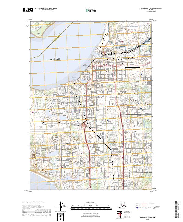
2023 Map of Anchorage A-8 NW
USGS Topo · Published 2023About this map
Anchorage serves as the central hub of this 2023 survey, revealing the dense infrastructure of Alaska's largest city. The map details a landscape defined by water and transit, from the industrial activity along Ship Creek and the Alaska Railroad to the sprawling grounds of Joint Base Elmendorf-Richardson. Residential districts like Turnagain Heights and Rogers Park are etched between major arterial routes such as Minnesota Drive and the Seward Highway. The intricate drainage of the Anchorage basin is visible through numerous water bodies, including Campbell Lake and the complex of Lake Hood and Spenard Lake adjacent to the Ted Stevens Anchorage International Airport. Institutional landmarks such as the University of Alaska Anchorage and the Anchorage Memorial Park Cem provide essential anchor points for local history and genealogical research within the urban grid.
Find a feature on this map
55 named features on this map. Tap any name to fly to it.
Don’t see what you’re looking for? This feature index may not catch every label — zoom into the map to look around manually.
Map Details
Editions of this 2023 Anchorage A-8 NW Map
This is the sole edition of this map. No revisions or reprints were ever made.
Other maps of this area

1949 · Tyonek
USGS Topo · 1:250,000

1951 · Anchorage
USGS Topo · 1:250,000

1951 · Tyonek
USGS Topo · 1:250,000

1951 · Tyonek A-1
USGS Topo · 1:63,360

1952 · Tyonek A-1
USGS Topo · 1:63,360

1952 · Anchorage A-8
USGS Topo · 1:63,360

1952 · Anchorage B-8
USGS Topo · 1:63,360

1953 · Anchorage A-8
USGS Topo · 1:63,360

1953 · Anchorage B-8
USGS Topo · 1:63,360

1958 · Tyonek B-1
USGS Topo · 1:63,360